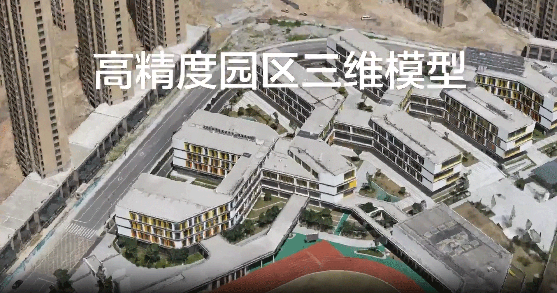
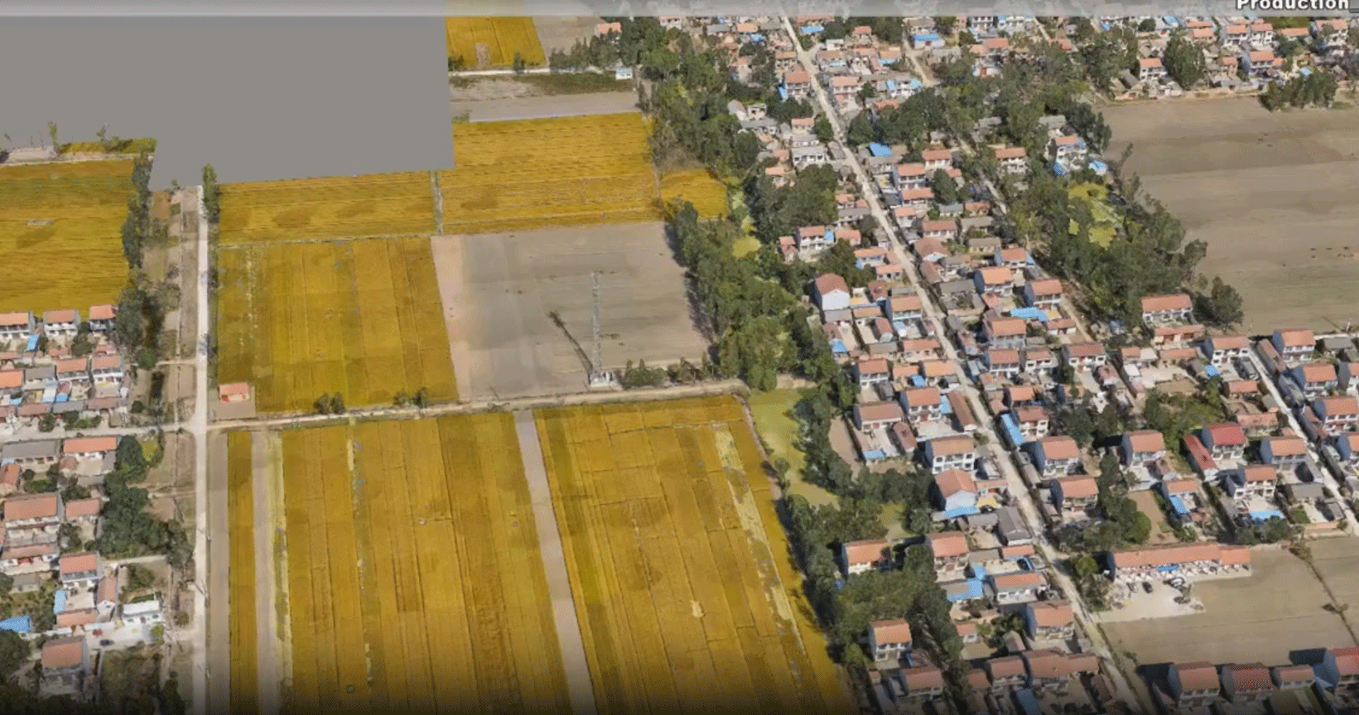
Smart City / Smart Park
To enhance social governance capabilities, smart city management systems need to be more intelligent, with accurate spatio - temporal big data as the foundation. Tilt - photography and LiDAR combined with drones are powerful tools for obtaining high - precision 3D models over large areas at low cost.
Efficient Collection
Benefiting from the features of Origin drones such as long endurance and multiple payloads, the single - collection area is large, and the collection efficiency is higher. It is especially suitable for large - scale data collection.
High Precision
It can meet the requirements of high - precision 3D models for 1:500 topographic surveying. The model has higher precision and better detail texture, perfectly reproducing the spatio - temporal 3D information of real - world scenes.
High - precision 3D models serve as the intelligent infrastructure. Various management systems are built upon it, enabling interconnection and intercommunication, rapid display and feedback, as well as accurate prediction to assist decision - making. Ultimately, this facilitates efficient operation and precise governance.


Cadastral survey is the demarcation of the land ownership boundary, which requires high accuracy. The use of Tianxuan's double-lens tilt photography scheme is easy to meet the cadastral survey requirements and passes the acceptance once. Under the standard load, the flight time exceeds 55 minutes, the area of a single sortie is large, and the efficiency is significantly improved.
Police and Firefighting Applications
Thanks to the continuous evolution of technology, unmanned aerial vehicles (UAVs) have become standard equipment for fire departments, armed police forces, anti - drug agencies, emergency rescue units, and other related entities, offering unparalleled advantages.

Illegal Activity Forensics
With the capabilities of high - frequency patrolling and long - distance evidence collection, UAVs leave no room for illegal activities to hide, ensuring comprehensive and accurate evidence gathering during law enforcement operations.

Rescue and Search Operations
Characterized by their outstanding maneuverability, UAVs are capable of conducting large - scale, high - precision reconnaissance missions. Even under adverse environmental conditions such as darkness and heavy fog, they can still execute effective search and rescue operations, providing crucial support for emergency response efforts.

Command and Traffic Regulation
UAVs enable remote command and control, as well as aerial regulation of pedestrian and vehicular traffic. Their wider coverage significantly improves regulation efficiency, thereby contributing to the maintenance of public order and safety.

Aerial Anti - drug Operations
Through large - scale, high - precision, and high - frequency patrolling, UAVs can conduct meticulous inspections for drug - related plants, leaving them with no place to conceal. This effectively bolsters the efficient implementation of anti - drug initiatives.
Geographical Information
Dozens of the top 100 geospatial information enterprises have already adopted our solutions and products. Thanks to the strong competitiveness and cost-effectiveness of our solutions, the efficiency of high-precision data collection and analysis has been significantly improved in an efficient manner.
Enhanced Efficiency
Leveraging German - originated composite material technology, our products achieve a 20% weight reduction while increasing structural strength by 10%. Coupled with multiple lightweighting techniques, this ensures extended flight durations and effective operational times. For instance, the OH6153 can maintain a 55 - minute flight with a 2KG payload, optimizing mission efficiency.
Enhanced Versatility
Our products feature a multi - functional design, enabling a single model to accommodate a diverse range of mission payloads. This flexibility allows users to select the most optimal configuration for different tasks, effectively addressing complex operational requirements with ease.

Greater Stability
Before any model enters production, it undergoes a rigorous testing process, including a minimum of 500 repeated test flights. These flights subject the aircraft to a wide range of complex environments and variables, ensuring that only models that meet the highest stability and reliability standards are released.
Greater Intelligence
Equipped with advanced AI algorithms and an autonomous control system, the unmanned aerial vehicle (UAV) is capable of intelligent path planning, automatic obstacle avoidance, and fault diagnosis. Through real-time data analysis, it can rapidly adjust the flight strategy and task execution plan, significantly reducing the cost of manual intervention and remarkably enhancing the level of operational intelligence as well as the decision-making response speed.


1:500 Cadastral Survey Solution
Cadastral survey involves the demarcation of the boundaries of land parcels and requires a high level of precision. The OH6153, equipped with a dual-lens oblique photography solution, can easily meet the requirements of cadastral surveys and ensure successful acceptance at the first attempt. Under standard payload conditions, its flight duration exceeds 55 minutes, allowing for a large survey area per flight mission, which significantly improves the survey efficiency.
Project Overview
In a town in Xiamen, Fujian Province, the survey area is 3 square kilometers of flat land, and the regional height difference is <20m. Accuracy requirements: 1:500 cadastre
Difficulty
The houses are dense and some areas are covered
Time is tight and field tasks are heavy
Equipment
Flying Platform:
OH6153
Gimbal:
dual-lens stabilized gimbal Z02
Camera:
Sony RX1R2
Flight
Flight altitude: 120m
Course overlap: 75%
Side overlap:
75%
Model Details
3D high-precision model with clear details and textures, flat facade, and clear data in the gaps between dense rooms, which is convenient for office mapping
Accuracy Verification
There are 137 detection points, the maximum error is 0.092 (4 out-of-tolerance filters), and the absolute medium error is 0.0408m, which meets the first-class (highest) requirements of 1:500 cadastral surveying and mapping, and can be completed at one time

1:500 Orthogonal Camera Without Image Control
It uses Tianyuan·Yaoguang with orthophoto gimbal, equipped with Sony RX1R2 camera, with long flight time, large single measurement area, high work efficiency, and is easily capable of 1:500 orthophoto.
Project Overview
The survey area is located in a city in Guangdong, with an area of 22 square kilometers
In flat areas, regional height difference <10m
Achievement accuracy requirement: 1:500
Equipment
Flying platform:
OH1803
PTZ:
Positive photo PTZ
Camera:
Sony RX1R2
Flight
Flight altitude 230 meters
Ground resolution 3.09 cm
Differential processing after PPK
Course overlap: 80%
Side overlap: 70%
Flight planning time:
30 minutes
Accuracy Verification
The orthophoto map is compared with the coordinates of 211 checkpoints,
Verification fully meets the accuracy requirement of 1:500 topographic map.


Power Line Patrol

Powerline Passage Inspection Services
Acceptance of newly constructed powerlines and establishment of original archives. This mainly includes: powerline passages (such as trees and houses), bridged crossings (including powerlines, highways, railways, etc.), power tower bodies (the safety distance and inclination of various components), the sag of grounding wires, and the distance between power cables.
For operating powerlines, measure the safe distance between cables and trees, newly-built houses, etc. Determine the growth trend of trees and bamboos, detect the sag of grounding wires under heavy load and high temperature conditions, and measure the distance between junctions and cables.
Conduct safety distance measurements before live-line work, such as measuring the dimensions of tower structures and the safe distance between cables.
Drones can effectively replace workers in powerline inspections. By utilizing a "frog jumping" cloud-native drone system, unmanned operation, remote scheduling, and fully automatic operation can be realized. This can significantly reduce the frequency of tower climbing operations and effectively alleviate the workload of inspectors.

Autonomous Precision Inspection of Transmission Lines
Relying on point cloud model data, autonomous precision inspection of transmission lines is conducted using flight platforms equipped with LiDAR (Light Detection and Ranging) and visible light payloads. The inspection scope encompasses key components, including the entire transmission tower, tower head, tower body, pole number plates, tower foundation, conductor suspension points, cross - arm suspension points, insulator strings, jumpers, jumper insulator strings, and the connection ends of jumper insulators with conductors and cross - arms.
With a single - click operation, inspection routes, shooting positions, and angles can be conveniently planned. The operation features a high level of automation and excellent safety performance. Line maintenance personnel can accurately determine whether there are defects in the towers based on the precise inspection data. Additionally, artificial intelligence technology can be utilized for intelligent defect identification. This not only significantly improves maintenance efficiency but also remarkably reduces the risks, costs, and inspection time associated with traditional inspection methods.

Autonomous Precision Inspection of Substations
Relying on point cloud model data, autonomous precision inspection of substations is carried out by using flight platforms equipped with LiDAR and visible - light payloads. The inspection mainly covers key equipment and components such as substation structures, lightning rods, wave traps, lightning rod counters, insulators, and oil level gauges.
Based on the 3D point cloud models reconstructed from pre - collected data, flight routes can be accurately designed, shooting orientations can be planned, and the distance between waypoints and target points can be flexibly set, enabling an autonomous and precise inspection process. During the intelligent inspection, drones can efficiently collect a vast amount of data and identify various equipment defects through machine vision technology. The application of this technology has significantly reduced inspection time and greatly improved work efficiency.


