

Geographical Information
Dozens of the top 100 geospatial information enterprises have already adopted our solutions and products. Thanks to the strong competitiveness and cost-effectiveness of our solutions, the efficiency of high-precision data collection and analysis has been significantly improved in an efficient manner.
Enhanced Efficiency
Leveraging German - originated composite material technology, our products achieve a 20% weight reduction while increasing structural strength by 10%. Coupled with multiple lightweighting techniques, this ensures extended flight durations and effective operational times. For instance, the OH6153 can maintain a 55 - minute flight with a 2KG payload, optimizing mission efficiency.
Enhanced Versatility
Our products feature a multi - functional design, enabling a single model to accommodate a diverse range of mission payloads. This flexibility allows users to select the most optimal configuration for different tasks, effectively addressing complex operational requirements with ease.

Greater Stability
Before any model enters production, it undergoes a rigorous testing process, including a minimum of 500 repeated test flights. These flights subject the aircraft to a wide range of complex environments and variables, ensuring that only models that meet the highest stability and reliability standards are released.
Greater Intelligence
Equipped with advanced AI algorithms and an autonomous control system, the unmanned aerial vehicle (UAV) is capable of intelligent path planning, automatic obstacle avoidance, and fault diagnosis. Through real-time data analysis, it can rapidly adjust the flight strategy and task execution plan, significantly reducing the cost of manual intervention and remarkably enhancing the level of operational intelligence as well as the decision-making response speed.

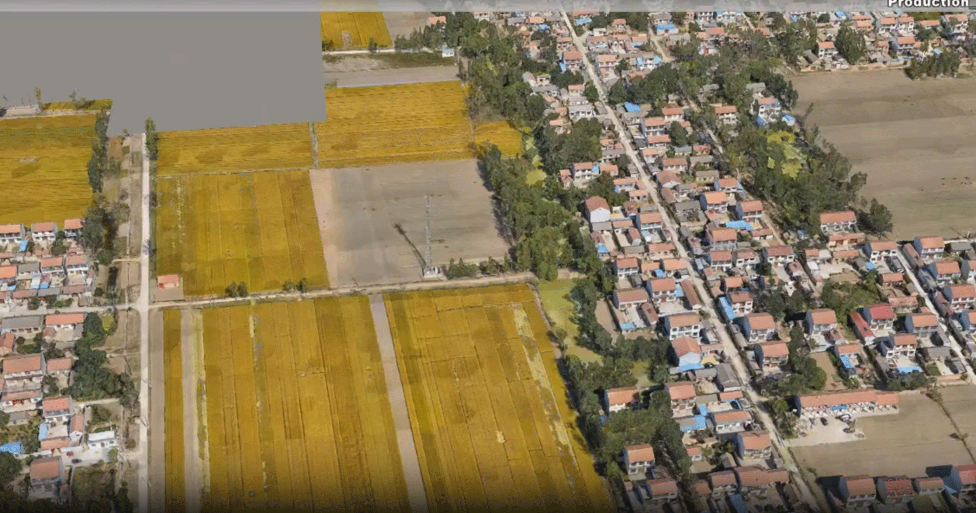
1:500 Cadastral Survey Solution
Cadastral survey involves the demarcation of the boundaries of land parcels and requires a high level of precision. The OH6153, equipped with a dual-lens oblique photography solution, can easily meet the requirements of cadastral surveys and ensure successful acceptance at the first attempt. Under standard payload conditions, its flight duration exceeds 55 minutes, allowing for a large survey area per flight mission, which significantly improves the survey efficiency.
Project Overview
In a town in Xiamen, Fujian Province, the survey area is 3 square kilometers of flat land, and the regional height difference is <20m. Accuracy requirements: 1:500 cadastre
Difficulty
The houses are dense and some areas are covered
Time is tight and field tasks are heavy
Equipment
Flying Platform:
OH6153
Gimbal:
dual-lens stabilized gimbal Z02
Camera:
Sony RX1R2
Flight
Flight altitude: 120m
Course overlap: 75%
Side overlap:
75%
Model Details
3D high-precision model with clear details and textures, flat facade, and clear data in the gaps between dense rooms, which is convenient for office mapping
Accuracy Verification
There are 137 detection points, the maximum error is 0.092 (4 out-of-tolerance filters), and the absolute medium error is 0.0408m, which meets the first-class (highest) requirements of 1:500 cadastral surveying and mapping, and can be completed at one time

1:500 Orthogonal Camera Without Image Control
It uses Tianyuan·Yaoguang with orthophoto gimbal, equipped with Sony RX1R2 camera, with long flight time, large single measurement area, high work efficiency, and is easily capable of 1:500 orthophoto.
Project Overview
The survey area is located in a city in Guangdong, with an area of 22 square kilometers
In flat areas, regional height difference <10m
Achievement accuracy requirement: 1:500
Equipment
Flying platform:
OH1803
PTZ:
Positive photo PTZ
Camera:
Sony RX1R2
Flight
Flight altitude 230 meters
Ground resolution 3.09 cm
Differential processing after PPK
Course overlap: 80%
Side overlap: 70%
Flight planning time:
30 minutes
Accuracy Verification
The orthophoto map is compared with the coordinates of 211 checkpoints,
Verification fully meets the accuracy requirement of 1:500 topographic map.

Xiamen Origin Drones Technology Co.,Ltd
Customer service:0592-5590708
Telephone:15392025973(Mr.Huang)
Email: huangkr@origindrones.com
Address: Building 81-3, Fuzhida - Zhihui City, Haicang District, Xiamen City, Fujian Province